 vesseltracker.com
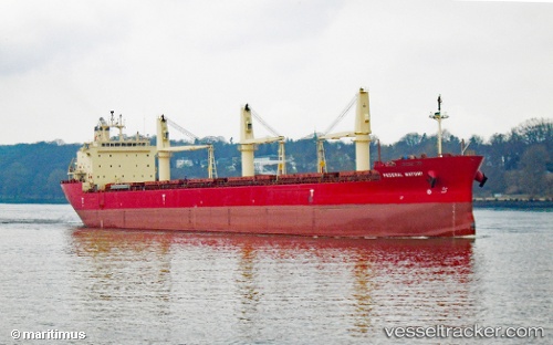
Vessel FEDERAL MAYUMI IMO: 9529578, MMSI: 538004646 Bulk Carrier
UTC, 17.13920, -57.55293, course: 318, speed: 12.9
UTC, 17.29602, -57.70983, course: 318, speed: 12.7
2026-02-14 10:10:35 UTC, 17.69655, -58.12477, course: 312, speed: 13.3
Live AIS position:
UTC. 189 nm NE of La Désirade),
updated 2026-02-14 10:10:35 UTC.
Find the position of the vessel FEDERAL MAYUMI on the map. The latter are known coordinates and path.
marine traffic ship tracker show on live map
The current position of vessel FEDERAL MAYUMI is 17.69655 lat / -58.12477 lng. Updated: 2026-02-14 10:10:35 UTCCurrently sailing under the flag of Marshall Islands
FEDERAL MAYUMI built in 2012 year
Deadweight:
35300 tDetails:
Last coordinates of the vessel:
UTC, 16.74359, -57.14715, course: 312, speed: 12.9UTC, 17.13920, -57.55293, course: 318, speed: 12.9
UTC, 17.29602, -57.70983, course: 318, speed: 12.7
2026-02-14 10:10:35 UTC, 17.69655, -58.12477, course: 312, speed: 13.3